1
2
3
4
5
6
7
8
9
10
11
12
13
14
15
16
17
18
19
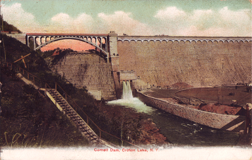
The New Croton Dam
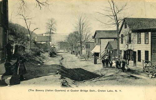
The Bowery
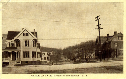
Maple Avenue
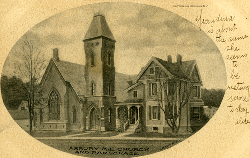
Asbury United Methodist Church
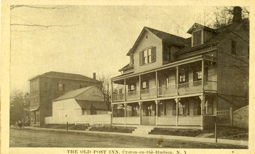
Old Post Road Inn
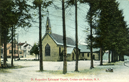
St. Augustine's Episcopal Church
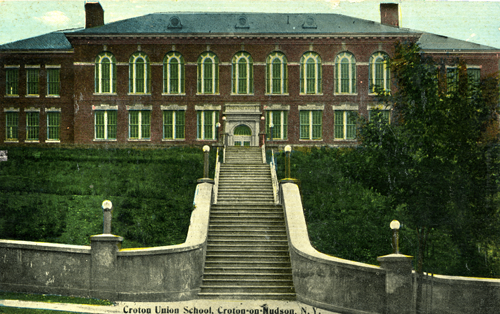
Croton Union School
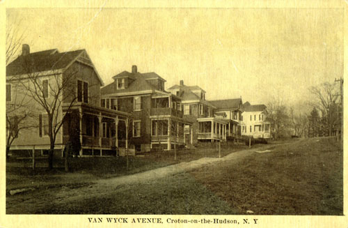
Van Wyck Avenue
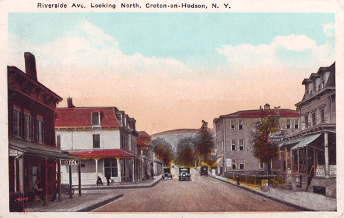
Riverside Avenue
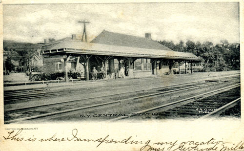
Croton Train Station
The inscription along the bottom of this circa 1906 postcard reads “This is where I’m spending my vacation.”
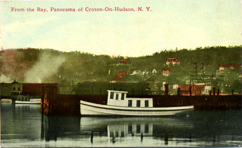
Croton's Waterfront
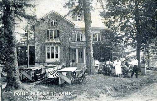
Point Pleasant Park
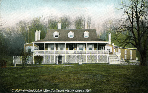
Van Cortlandt Manor
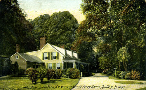
Van Cortlandt Ferry House
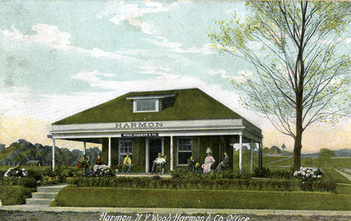
Harmon Sales Office
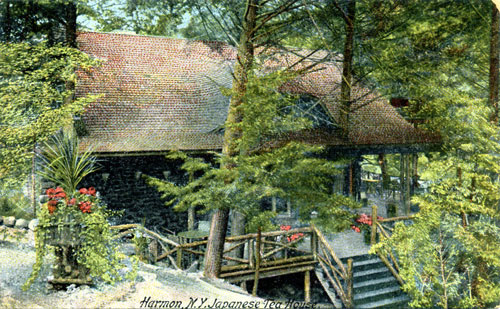
Nikko Inn
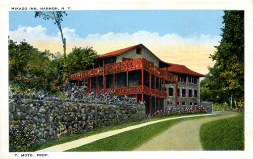
Mikado Inn
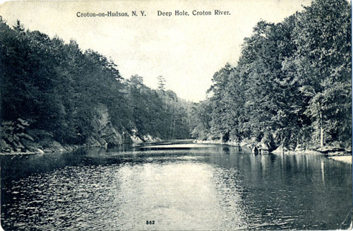
Deep Hole
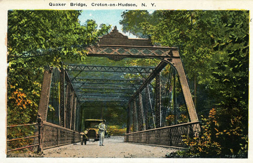
Quaker Bridge
The Quaker Bridge we use today was built in 1894 and is one of Westchester’s oldest surviving bridges. Indeed, survival was a real issue with 18th and 19th century Croton River bridges, because spring “freshets” of melting snow or heavy rain tended to wash away early wooden bridges with surprising regularity. The 1894 bridge is actually the fourth bridge built at this location. The first was built in 1809, to carry Albany Post Road traffic across the river, avoiding the cost of the ferry at Van Cortlandt Manor. That bridge was rebuilt in 1830 by local Quaker preacher, William Purdy, hence the name “Quaker Bridge”. In 1841, Purdy’s bridge was swept away—along with all the other Croton River bridges, many houses and several mills—when part of the original Croton Dam collapsed, releasing a torrent of water that was 50 feet high when it roared through the narrow Croton River Gorge. The dam was repaired and improved, so when the third bridge was built in 1847 it survived for 47 years until the current Pratt truss style bridge replaced it.
One of the most interesting things about Quaker Bridge is what was not built there. In the late 19th century, when New York City was rapidly outgrowing it’s water supply, the Quaker Bridge area was the subject of extensive planning for a new dam that an article in the New York Sun in 1888 called “The Biggest of All Dams … the Gigantic Structure at Quaker Bridge.” Luckily, the planners decided against the Quaker Bridge location in favor of one further up river.
Copyright © Croton Friends of History / Powered by Squarespace.